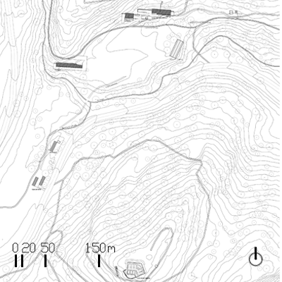
Our reading of the fortified mountain landscape of the Pyrenees reveals a way of engaging with the linear territory, shaped both by major infrastructures such as the Pau–Canfranc tunnel or the imaginary P Line linking the fortifications, and by the natural flow of rivers through the valleys, as well as routes, paths, hunters’ trails, or the Camino de Santiago itself.
Nuestra lectura del entorno de las montañas fortificadas del Pirineo descubre una forma de sumarse al territorio lineal, con grandes acontecimientos como el túnel Pau-Canfranc o la Línea P imaginaria que une las fortificaciones; y el fluir natural de los ríos en los valles o los itinerarios, sendas, caminos de cazadores o el mismo camino de Santiago.
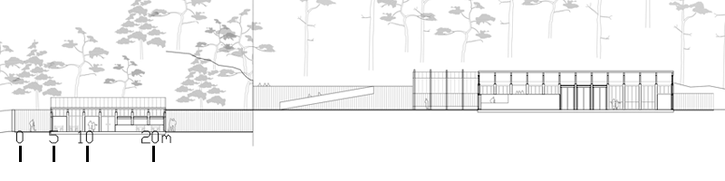
The relationship with the pre-existing elements is primarily visual: from the plain, the interpretation cultural centre looks towards the fortification rising on the mountain.
La relación con la preexistencia es visual: el centro de interpretación observa desde el llano la fortificación sobre el monte.
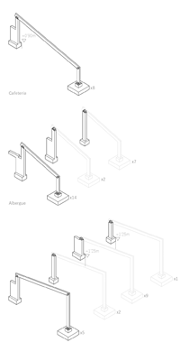
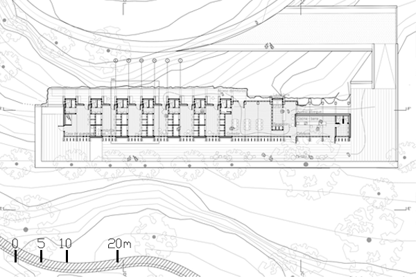
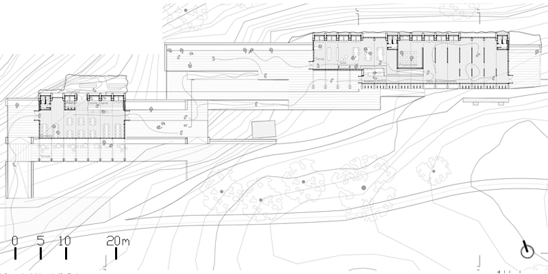
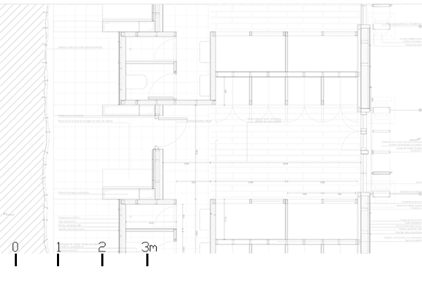
The interpretation cultural centre is complemented by the café and hostel facilities, all connected through the rhythm of the path established by the structural system, the platforms embedded in the terrain, and the continuation of the existing traces.
Al centro de interpretación se suman las piezas de cafetería y albergue, unidas mediante el ritmo del camino establecido por la estructura, plataformas en el terreno, y continuando las trazas de la preexistencia.
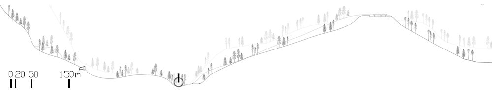
The project begins with an itinerary, a path along which new landmarks emerge and connect with existing ones, with the main purpose of observing and studying the Fort of La Sagüeta, while approaching the former smelter of l’Anglasé. The route plays with distances and encounters, reveals landmarks, leaves the road, listens to the river… just as the experience of the walker becomes part of the path itself.
Partimos de un itinerario, un camino en el que surgen hitos nuevos y conecta con los anteriores, con el objeto principal de mirar y estudiar el Fuerte de la Sagüeta, y acercándonos a la antigua fundición de l’Anglasé. El recorrido juega con las distancias, con los encuentros, descubre hitos, abandona la carretera, escucha el río, ... como la propia experiencia del caminante forma parte del camino.
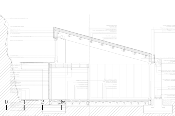
The reading of the Fort of La Sagüeta, the mountain, the valleys, and the quarries and resources that were extracted and processed in this place provides the key to the manipulation of the terrain. Our path sinks slightly into the ground, and the architectural elements add to the perforation of the mountain. The inclusion of the walker’s transient presence establishes a dialogue between a lightweight covering that structures the path and the transformation of small cavities in the mountain into the required landmarks for the interpretation centre as a whole.
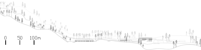
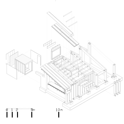
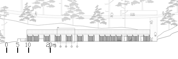
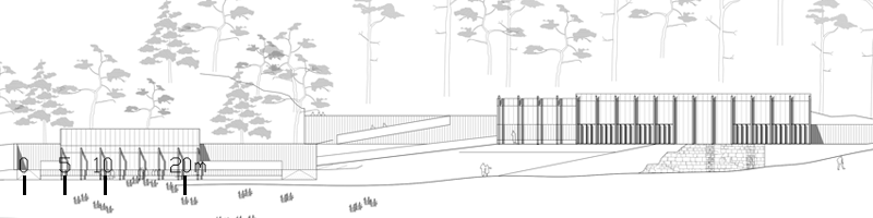
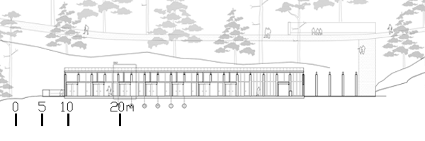
The result is a play between topography and a light, ordered framework. The terrain is terraced and excavated; access fissures and resting courtyards are opened, just as the moat was once excavated and the mass of La Sagüeta was raised. The spaces are covered by a structured and rhythmic system that directs the gaze for observation and accompanies the visitor along the route. The lightweight roof is composed of slender structural elements that are echoed by heavier components embedded in the ground. This topographic manipulation is also expressed in section, as box-like spaces emerging from the terrain without reaching the roof.
La lectura del fuerte de la Sagüeta, de la montaña, de los valles y de las canteras y recursos que se han extraído y fundido en este lugar nos aportan la clave de la manipulación del terreno. Nuestro camino se hunde ligeramente en el terreno, y nuestras piezas se suman al horadado de la montaña. La suma de la componente volátil del caminante hace un juego entre un recubrimiento ligero, que pauta el camino, y convierte los pequeños huecos en la montaña en los hitos requeridos para el conjunto del centro de interpretación. El resultado es el juego de la topografía y la pauta ligera. El terreno se abancala, excava, se abren grietas de acceso o patios de descanso, como ya se excavó el foso y se levantó la mole de la Sagüeta. Los espacios se cubren con una estructura pautada y ordenada, que direcciona la mirada para el estudio y acompaña al visitante en su camino. La cubierta ligera parte de unas piezas estructurales ligeras que tienen su reflejo en otras más pesadas insertadas en el terreno. La manipulación topográfica se traslada también a la sección como cajas que surgen del suelo y no llegan a tocar la cubierta.